Mapping the Weinsberger Berge
From my OSM Diary
Inspired by Tom7 to go outside more, I set myself the goal of biking every Forestpath between Weinsberg and Heilbronn, before I will be moving avay in the Summer.
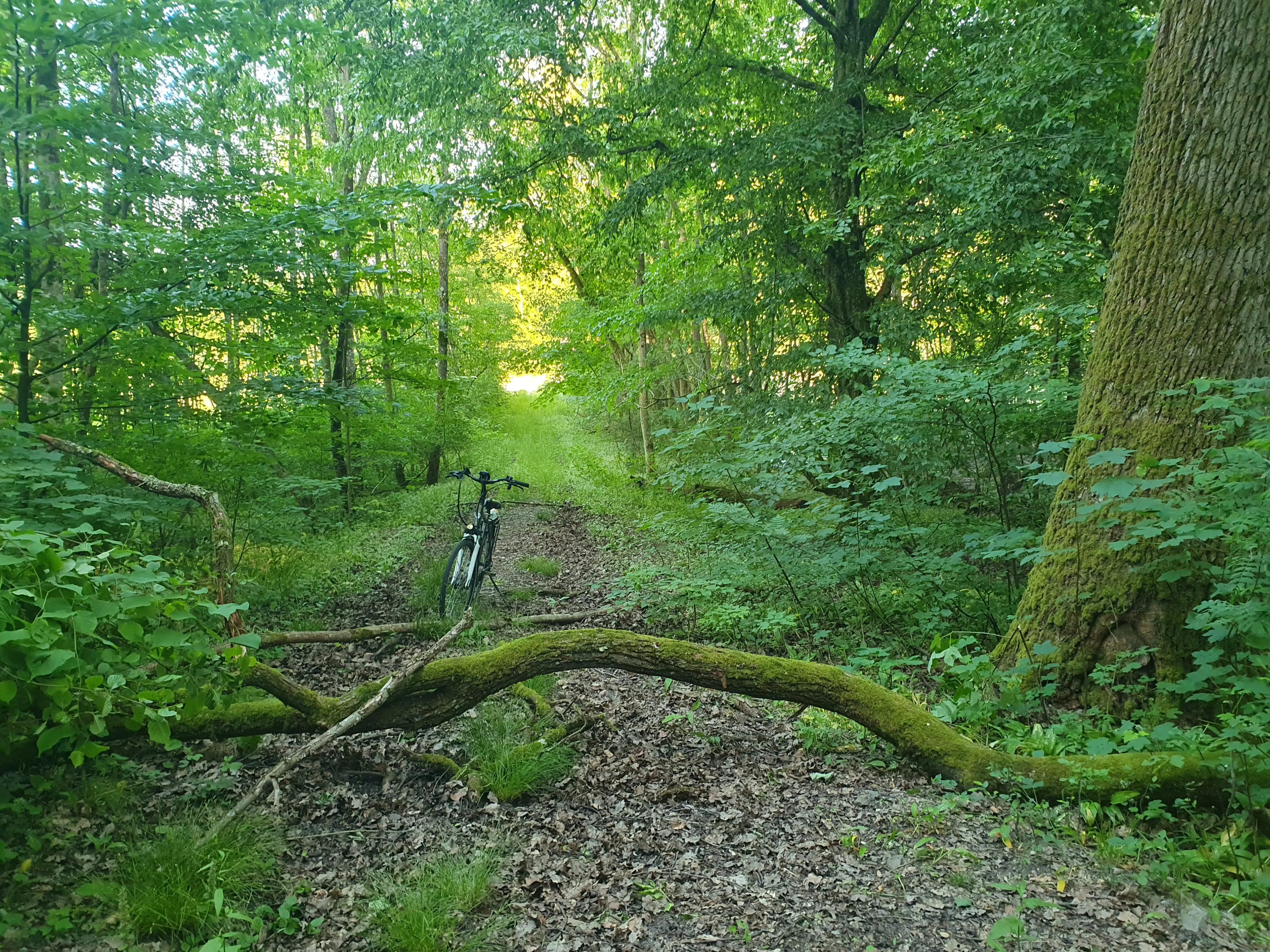
In the process I stumbled across many Tracks that need updating. Many have overgrown to the point of unusability, others are not mapped yet. One of the biggest challenges for the Forest in my opinion is deciding which Harvester Tracks should be mapped and which not. On a normal Field you wouldnt map every Tracktor Track, but in the Forest these Paths sometimes turn into paths used by the public. They are pretty volatile though. In the tree felling season they look like high traffic Tracks, very compacted, traversible by normal Trucks. But they are also not maintained, so quick to overgrow and turn very muddy to barely passable with a bike after a few days of rain.
This weekend I was able to complete the 4th of my areas and I wanted to take stock. I have driven every Path between Donnbronner Landstraße, Heilbronn and L1111. This includes the Schweinsberg, the vineyards, Köpfertal and Büchelberg. I also drove every path in Weinsberger Tal and the Waldheide between Donnbronner Landstraße, A81 and the Verwaltungsgrenze Weinsberg in the South.
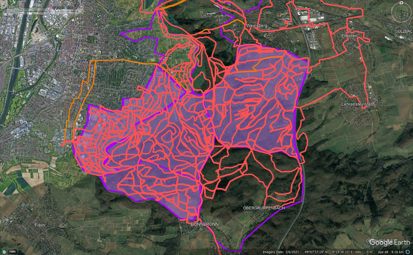
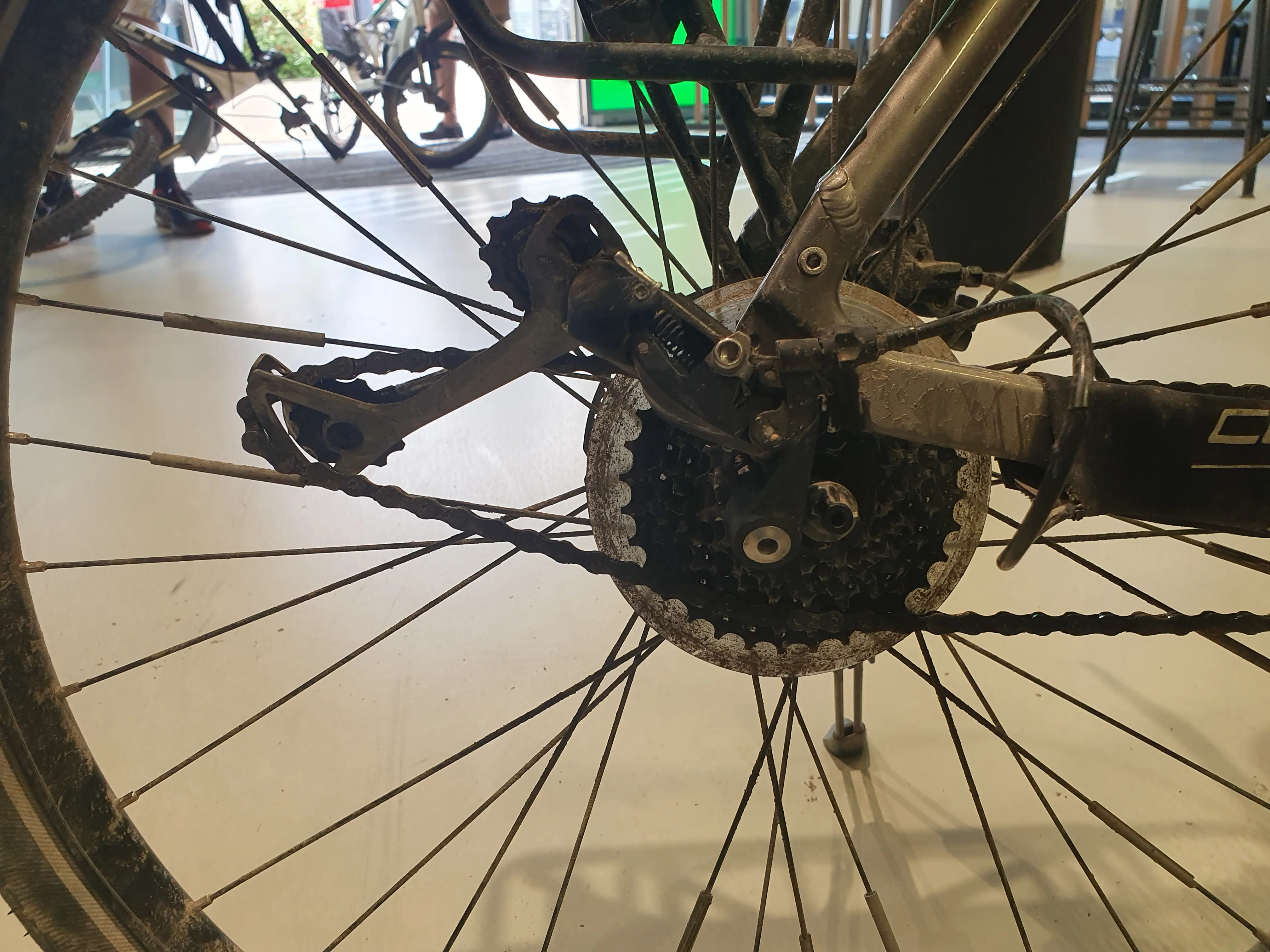
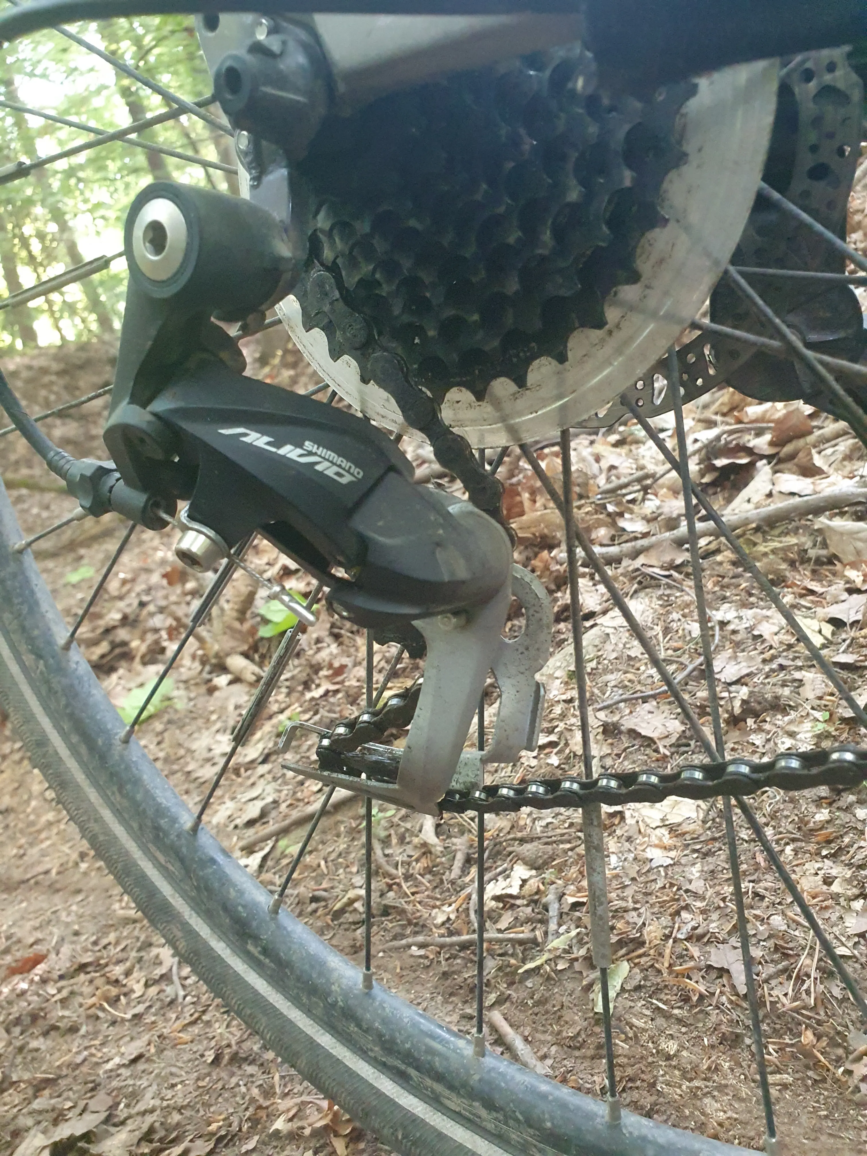
I traveled 515,6km, created 38 changesets. I only crashed the Derailer on my City E-Bike twice (🥴), but overall I'm pretty happy with my work.
The Bike is honestly not suited for this task, a Mountain Bike would be the much better choice. But I usually don't ride such treacherous trails.
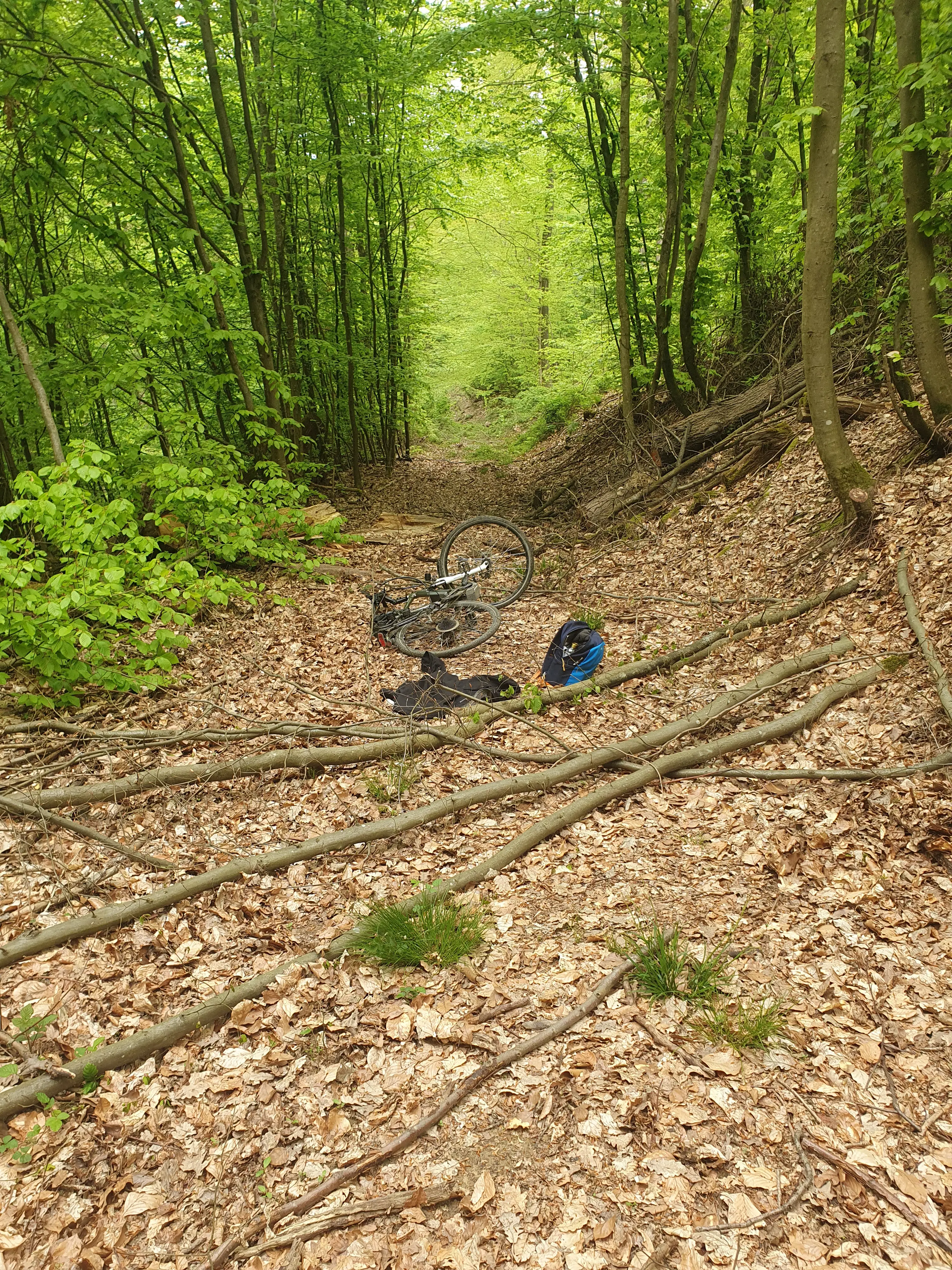
Got a Branch between the Spokes not only killed the derailer, but also unseated the back wheel. Never had that happen before, and also had to carry the heavy bike out on my back, because the Track was definitely not drivable with my car.
Only 200km later it happened again. This time it seemed to catch in the Spokes on its own. Wasnt even such a mountainbikey trail.